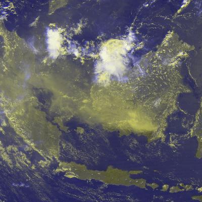
Borneo Fire Causing Smog in SE Asia
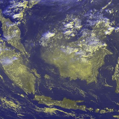
- Sep 1, 1997 (05GMT) Composit of Visible (R and G) and InfraRed (B)
channels of GMS-5, showing 100E - 120E / 10N - 10S area with
1/20 degree resolution per pixel.
There is a cluster of low level cloud in the southern Borneo.
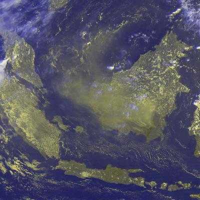
- Sep 2, 1997 (05GMT)
- Sep 3, 1997 (05GMT)
- Sep 4, 1997 (05GMT)
- Sep 5, 1997 (05GMT)
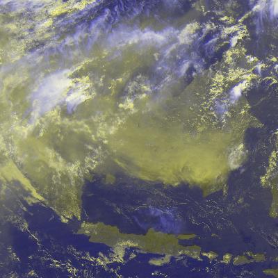
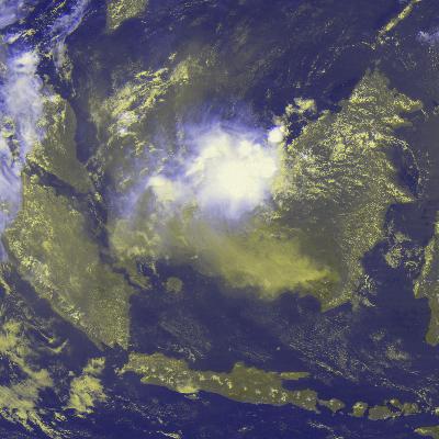
- Sep 25, 1997 (05GMT)
The smog-covered area extends Borneo, Peninslar Malaysia, Sumatora and wider.
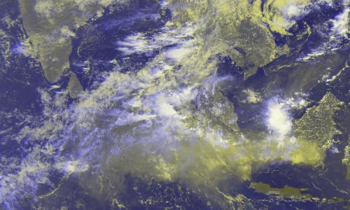
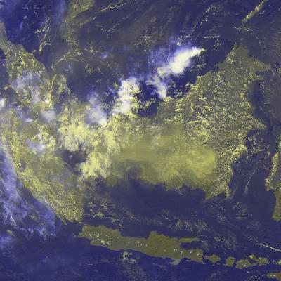
- Sep 29, 1997 (05GMT)
This image shows wider area (70E - 120E / 20N - 10S) in 1/10 degree resolution
per pixel.
Suggested further reading:
-
Asian Fire Crisis Deepens in
TIME Daily
-
NOAA-14 Images in
NOAA National Climatic Data Center
Redistribution of above images is unlimited as long as credits are
made to
Japan Meteorological Agency for the operation of GMS-5
(Geostationary Meteorological Satellite),
University of Tokyo for
receiving and processing the S-VISSR (Stretched signal of Visible and InfraRed
Spin Scan Radiometer) and
Kochi University
for the final processing and publicizing the images.
Further request for research-quality images should be sent to
Tokio Kikuchi.